Icons and Symbols of Annapurna Base Camp Trek Map
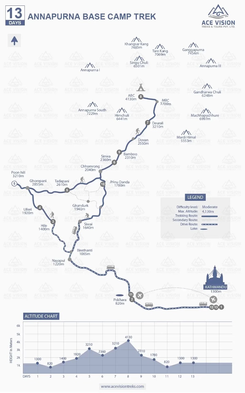
Vehicle Icons
The vehicle icons are used along the routes between Pokhara, Kathmandu, Nayapul, and Siwai. These represent the sections of the journey that involve road transportation. This helps you distinguish between driving and walking routes.
Mountain Icons
Triangular icons for the mountains show the major Himalayan mountains that surround the trekking route. Every mountain's name along with its height is included in the map.
These icons help trekkers identify the mountains seen along the trail and understand the overall layout of the Annapurna Sanctuary.
Tent Icon
A small tent symbol is used at Annapurna Base Camp (ABC 4,130 m). This denotes that at the base camp, there are tents also available.
It indicates that ABC is not only the highest point but also a significant resting spot where climbers can stay overnight in the midst of the mountains.
Hiker Icon
The map shows a walking hiker icon at various sections, starting at Hile, which marks the beginning of your journey. It can also be seen between Tadapani and Chomrong and at Dovan highlighting journey on foot.
The icon also indicates the trail descending toward Siwai. By carrying the map, trekkers can get insights into both ascending and descending sections and be well prepared. This symbolizes the sections of the track of the actual trekking, highlighting the sections that you will navigate on foot.
Airplane Icon
There is an airplane symbol near Pokhara. This shows that air travel between Kathmandu and Pokhara is an option. The trekkers who prefer to save time take this flight instead of the long drive.
Lake Icon
A lake-shaped icon is shown near Pokhara (820m), representing Phewa Lake, one of Pokhara’s most famous attractions.
Main Established Trekking Route
The thick continuous line represents the main trekking trail from Hile all the way up to Annapurna Base Camp and back. This helps you find the main trekking path visually, step by step, through villages and high-altitude stops.
Secondary Route
The dashed line indicates secondary routes. After you enjoy your time at a hot spring in Jhinu Danda, you may also choose to explore the Ghandruk village. This line symbolizes the alternative trekking path between Jhinu Danda, Ghandruk and Siwai which you can choose to take during the journey.
Legend Box
At the bottom-right, above the altitude chart, you can see the legend box. It explains the difficulty level (Moderate), maximum altitude (4,130 m) and the meaning of trekking, secondary, and driving route icons.
This short explanation of icons helps you interpret the map symbols and use chart effectively for planning.
Key Features of the Annapurna Base Camp Trek Physical Map Provided by Ace Vision Treks
The physical map of Annapurna Base Camp Trek is designed to make your planning and navigating your adventure simple and enjoyable. The layout and design helps trekkers can quickly understand route and terrain. We here at Ace Vision Treks also provide a physical map with the following features:
Trek Duration and Trail Start to End Points
At the very top, the map highlights the title of the trek, Annapurna Base Camp with a total duration of 13 days. This provides quick insights into the entire journey. It also ensures that the trek is well planned with fixed itinerary.
By clearly stating the duration, you can know about the time commitment required. The journey begins in Kathmandu. You can then either drive or fly to Pokhara. Afterwards, you will again enjoy another drive to Hile from where the actual trek starts.
The return journey is also clearly mapped out. The journey on foot ends in Siwai which is also clearly marked. Then, you will get back to Pokhara, enjoying a road journey. By clearly stating the duration and ending, and starting point, the map helps you understand the time commitment required.
Key Trekking Route and Villages
The map outlines both main trekking route and secondary trails. The solid line shows main trekking path. The line starts from Hile (1400 m) and continues through villages like Ulleri (1920 m), Ghorepani (2885), Tadapani (2,610 m), Chhomrong (2,040 m), Bamboo (2310 m) and Deurali before reaching Annapurna Base Camp.
Secondary trails are indicated by dotted line for itineraries with alternatives. You can choose secondary route, explore Ghandruk and head towards Siwai from where the journey on foot ends.
Mountain Peaks and Scenic Highlights
The map points out some of highest Himalayan peaks visible along the trail. These include Annapurna I (8,091 m), Annapurna South (7,229 m), Machhapuchhre (6,997m), Hiunchuli (6,441 m) and Gangapurna (7,454 m) and many others.
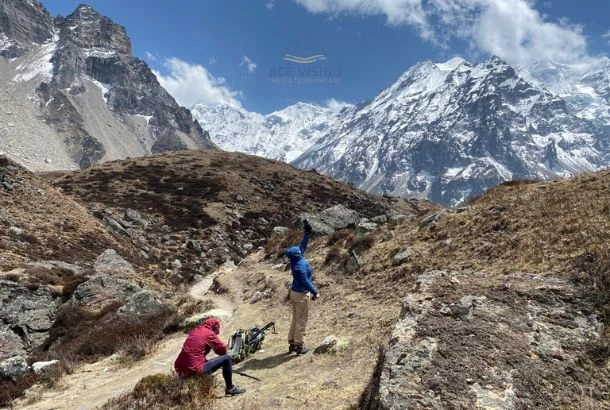
The trek rewards you with close up views of mountains from various viewpoints particularly from Poon Hill and Annapurna Base Camp.
The elevation markings allows you to anticipate gradual ascent. It helps you enjoy evolving landscape from forested areas at lower levels to alpine terrain near base camp.
Altitude Chart and Difficulty Level
At the bottom, the altitude graph provides a good illustration of elevation change over the 13 days. It starts at Kathmandu (1,300 m) and takes you down to Pokhara (820 m). Then, the trail gradually rises to the highest point at Annapurna Base Camp (4,130 m). Afterward, you will trek through places like Bamboo, Jhinu Danda, and then drive to Pokhara.
The map lables the trek as moderately difficult which is suitable for fit people. While trek demands you to be physically fit, expert-level mountaineering skills are not required.
The clear ups and downs in the altitude graph emphasize the requirement of acclimatization with the overnight stay at key locations. This well structured itinerary minimizes the risk of altitude sickness and ensures a secure overall trekking experience.
Why is Carrying Physical and Digital Maps Recommended During the Annapurna Base Camp Trek?
Having route map is crucial for Annapurna Base Camp Trek. For a secure journey it is best to have both a digital and physical map. Both of the maps are reliable and can help you make right decisions in mountains.
The digital map combined with a GPS, provides real time guidance on paths, nearby landmarks and your location. It can also show live weather forecasts and track changes in your altitude. So, you can adjust your walking pace accordingly.
At the same time, technology should not be relied on exclusively. The remote areas especially the signal coverage may not always be good and charging facilities for electronic devices can be very minimal. Since digital devices need power and signal to function, there may be instances where they won't work.
So, having a paper map is essential. These maps don't need batteries, signals or networks. They are usable for a long period and provide a reliable backup whenever digital devices don't work properly.
To have a secure and confident experience it is strongly advisable to carry both maps. They provide the reliability, accuracy and flexibility needed for high altitude ventures like Annapurna Base Camp Trek.
Annapurna Base Camp Trek: Popular Landmarks Along the Map
Hile
The Annapurna Base Camp Trek usually begins from Pokhara (822 m). It is marked on the map with an airplane or bus icon. From here, the road stretches out to Hile (1400). It is one of the popular gateways of the ABC treks.
Ulleri
It is one of the popular villages along the route. It is situated at an elevation of 1920 m and is popular for its long stairways which can be demanding but equally rewarding and exhilarating.
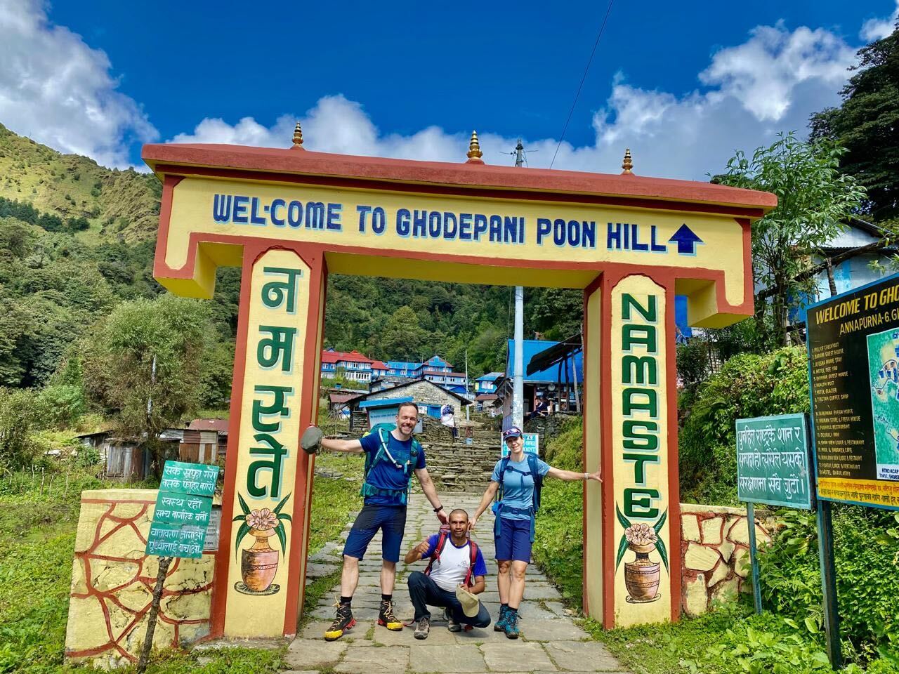
Ghorepani Village and Poon Hill
Ghorepani Village (2855 m) is one of the key stops along the trail. Here, people stay overnight and the next day they hike towards Poon Hill.
Poon Hill (3,210 m) is one of the notable attractions along the ABC trek from where exceptional views of sunrise and mountains like Nilgiri, Annapurna, Gangapurna and many others can be seen, elevating the sightseeing experience of the trekkers.
Tadapani (2610 m)
It is a small village in the Annapurna Region and is popular for its scenic views. It is a common overnight stop for trekkers
Chomrong
Chomrong (2,040 m) is a serene village on the trail of the Annapurna region from where you can see the impressive views of the Annapurna range.
It is also one of the major stop points along the trail where trekkers generally rest. It stands out as one of the favourite spots of trekkers along the trail to the Annapurna Base Camp.
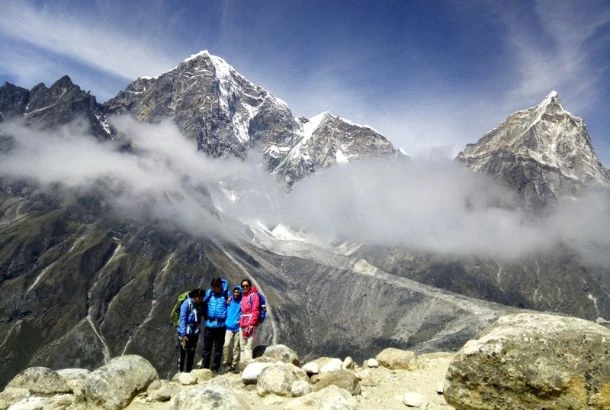
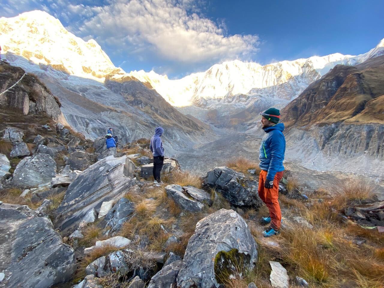
Machhapuchhre Base Camp
Machhapuchhre Base Camp (3,700 m ) is another scenic destination along the trail. It is situated at base of the iconic Fishtail Peak. It is known for stunning views of snowy peaks. Many trekkers also stay overnight here before moving upwards to ABC.
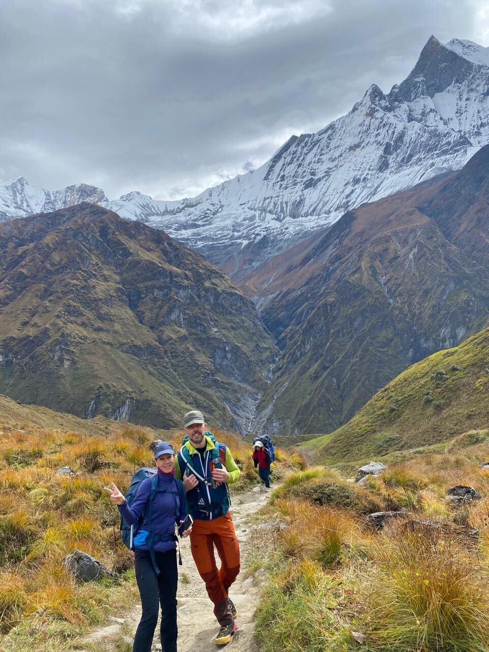
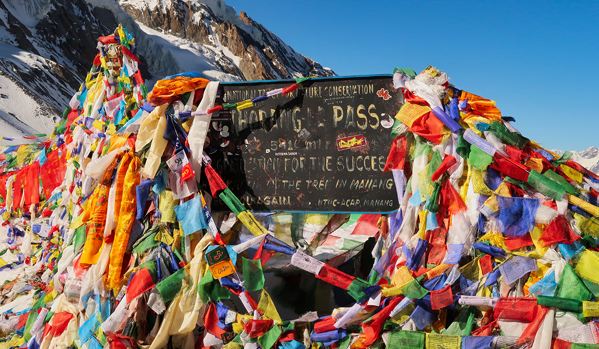
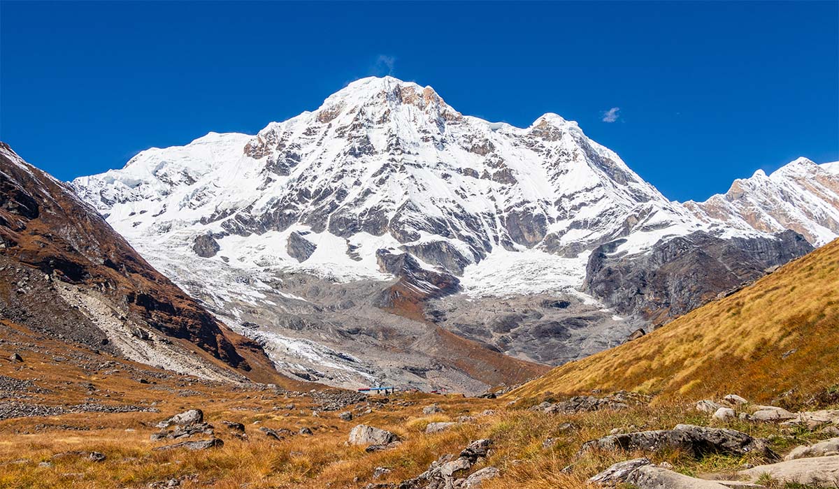
Annapurna Base Camp (4,130 m)
The most scenic destination on the trek is Annapurna Base Camp. It is surrounded by the stunning Himalayas and presents beautiful views of Annapurna and other mountains.
Jhinu Danda
Most trekkers on their return stop by Jhinu Danda (1,780 m). It is a village famous for its natural hot springs.
The place is perfect for relieving muscle fatigue after navigating the varied spots along the trail of Annapurna Trail.
Why Choose Us for Trekking Adventures?
Looking for a well organized journey in the Himalayas? At Ace Vision Treks and Tours, we provide an organized journey and offer exciting adventures. Whether you want easy paced hike or challenging adventure, we are here to guide you with care and expertise.
Our Goal
Ace Vision Treks is established with one clear mission, which is to be Nepal's most trusted trekking partner for visitors from across the world. We welcome travelers from every corner of the globe and strive to create journeys filled with unforgettable memories.
We focus on sustainable tourism and cultural exchange. In addition, we aim to provide personalized service so that every trip leaves lasting impact.
Knowledgeable Local Team
Our biggest strength is our team. Our team is made up of local Nepali professionals. We have knowledgeable guides and hardworking porters
All of our porters and guides grew up in the very same local area that you will be trekking through. They know about the region, the weather, the customs, and the mountain way of life. They work hard to make every step of your trek safe, enriching, and well-informed. Their warm and genuine hospitality will enhance your overall experience.
Simple Online Booking System
Booking with Ace Vision Treks is easy and simple. You can visit our website and quickly browse trips, check the itineraries, ask questions, and make an online booking. Just send an email to [email protected] or message us directly on WhatsApp at +977 9851025312.
Remarkable Trip Success
Our tours have a good success record. Every itinerary is crafted with thoughtful planning, wise pacing and sufficient acclimatization.
With our seasoned staff leading you hundreds of climbers and trekkers have met their goals safely and have enjoyed their experience.
Transparent Pricing
We keep our pricing transparent. While booking you will know what is included in your package. There is no surprise or last minute extra cost. You can book your package with confidence, knowing the cost is clear right from the start.
Personal Guide Selection
All our guides are licensed, first-aid certified, and committed to ensuring your safety. You can choose your own guide.
You can let us know your preference on whether you would like a male or female guide or need the guide to be proficient in a specific language.
After learning about your preference, we will ensure that the right person will accompany you so that your adventure will be convenient and enjoyable.

Flexible Itineraries
We recognize that each adventurer is unique. We have crafted a standard itinerary for every destination. However, if you want to see more scenic villages, need more acclimatization days or need to change plans you can request us for customization and we can adjust the itinerary to your preference.
Focus on Safety
At Ace Vision Tours and Treks, we are there to support you from the moment you contact us until the end of your journey.
We keep your safety as our top priority on the trek. Our team is trained in first aid so you will get the needed support if there is an emergency. With reliable equipment and highly trained team we make your experience safe and enjoyable.
Last Minute Trip Assistance
If you are already in Nepal and make an instant decision the trek but aren't sure how to manage logistics, there is no need to worry. We have got you covered.
We can arrange permits, guides, and gear in advance so that you can fully focus on your Himalayan adventure without worrying about anything.
Guided By Experts
With more than 13 years of experience of leading treks along Nepal's routes, our team is expert in crafting itineraries and leading the Himalayan adventures.
With proper guidance and a professional team we will support you to overcome challenges and try our best to make your experience memorable in the Himalayas.
Private Tours
Dreaming of a private trip in Nepal? We arrange private treks where you can set the pace, make the side excursions, and enjoy the personalized experience.
Frequently Asked Questions

Why is the Annapurna Base Camp Detailed Map Necessary While Trekking?
A map is one of the most useful tools you can carry on the Annapurna Base Camp Trek. The map has clear icons and also an altitude chart. So, you can get quick insight into the route, plan for each day, estimate walking hours and plan rest or acclimatization days more effectively.
With a map you can navigate the trail with confidence and also ensure safety to adjust your route or pace along the way. So, having a map is necessary.
Which Map is Recommended for the Annapurna Base Camp Trek: Paper Map or a Digital Map?
For the Annapurna Base Camp Trek it is essential to carry both maps. A paper map is more dependable as it does not depend upon a battery. When you are far from charging points or mobile signals, this map is the most useful.
A digital map allows you to track your position in real time. It often shows details like elevation, distance and also nearby tea houses. By having both maps you can stay confident and prepared enjoying the trek with peace of mind.
How Reliable is the Altitude Information in the Annapurna Base Camp Trekking Map?
The numbers written on the map are precise. It is based on official surveys. The maximum elevation you will reach during Annapurna Base Camp Trek is 4,130 m.
With accurate altitude details on the map, you can plan your trek more wisely. This also helps minimize the likelihood of altitude sickness and makes overall journey joyful and secure.
How Does the Map Help Prevent Altitude-Related Problems?
In the map, every major stop is marked with its altitude. With this information, you can smartly plan the rest days. This can help in acclimatization, pace management which lowers your chances of altitude sickness on the way up to Base Camp.
Does the Annapurna Base Camp Trek Map Show Villages or Stops Along The Route?
Yes, the popular villages and scenic stops along the trail are clearly marked along the trail. This makes planning each day much easier. It is especially helpful for first time trekkers. They can get clear idea of the journey ahead with a map.
By using the map trekkers can plan breaks at these spots. In addition, they won't be missing any key highlights on the trail and get to explore the best must see places of the Annapurna Region, which will make the journey joyful and memorable.